Augmented Skies
October 2011software, augmented reality, rca
software, augmented reality, rca
Vauxhall in the London borough of Lambeth is the location of a massive residential skyscraper construction programme. This includes St George Wharf Tower (181 metres), the Vauxhall Island Towers (170 metres and 100 metres) and Vauxhall Sky Gardens (130 metres). For the Design Philanthropy brief at the RCA, Mike Vanis and I examined how we might enable current residents to understand how these future developments will impact their lives and their community. As a part of this exploration we created Augmented Skies to look at the language of planning.
The images below are two representations of the now approved Vauxhall Island Towers by the architects Squire and Partners. They are typical of current practice. Both necessarily abstract their rendering and position the viewer outside the everyday experience of a Vauxhall resident. The specifics they do include are idealised; the blue sky and the green trees.
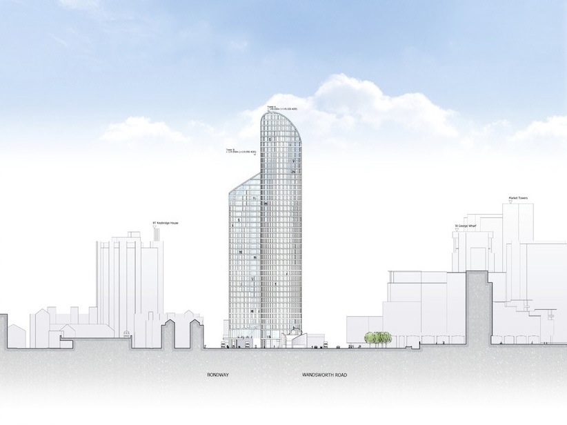
Vauxhall Island Towers - Copyright Squire and Partners
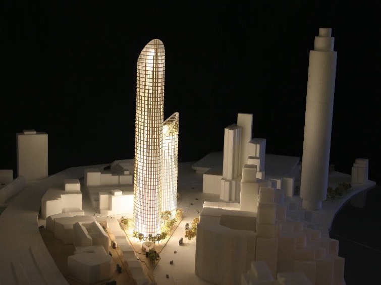
Vauxhall Island Towers - Copyright Squire and Partners
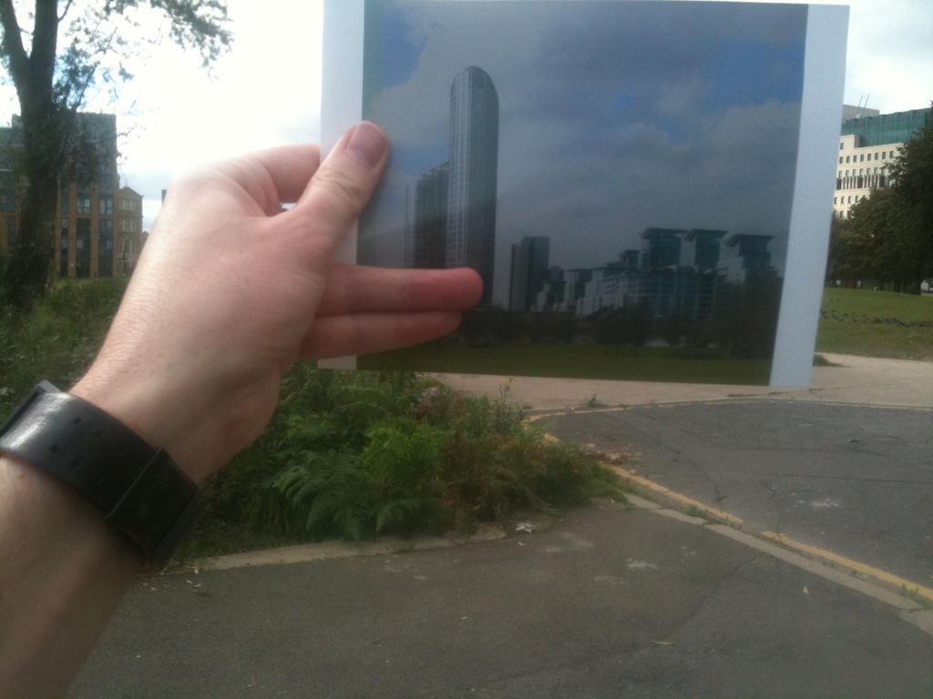
The third architectural rendering before shows the towers as seen from Spring Gardens, below left. Note the exclusion of the St George Wharf Tower. While the image gains specifics, it is still viewed out of context, typically on the page of a newspaper or on a website. We applied the technique of rephotography, usually used for historic photographs, to situate the image in the physical world, below right. In doing this exercise the viewer has the physical experience of seeing the building in context; crooking their necks to see the top.
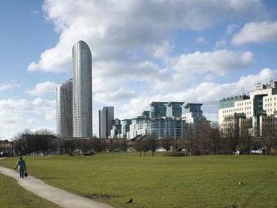
Vauxhall Island Towers - Copyright Squire and Partners
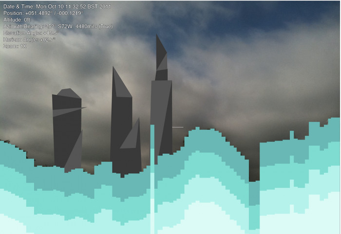
While rephotography gives us a new way to see these images, it does not free us from the viewpoints selected by the architect. To address this we created an Augmented Reality application running on an Android phone that allows views of the towers to be seen from any position and angle. The app uses the camera, GPS and compass to augment the user’s view appropriately. The blue horizon is automatically generated and stylised views of the buildings are inserted behind.
These ideas were further developed in Know Your Place 2.0.